#195
Sentinel-1 C-SAR
European Space Agency
10 m6-day revisitNo data fee
Websites, online shops, 3D, AI assistants and the systems behind them. Designed and built by two founders you work with directly.
Most studios do one part. We design and build the whole thing, from the website and the shop to the 3D, the AI and the systems that connect them. A handful of projects a year, done properly.
Fast, beautiful websites that make it easy for people to understand you and get in touch.
For example, a professional-services firm where booking a consultation takes two clicks.
Products, payments, shipping and stock that stay in sync — built around how you actually sell.
For example, a premium brand shop with secure checkout and an age check at the door.
Custom 3D models and interactive experiences, so customers can spin, configure and explore what you make.
For example, your furniture in 3D: pick the fabric, see it change, add it to cart.
Assistants that answer customers any time, and automations that take the busywork off your team.
For example, a website assistant that answers common questions at 2am and books the call.
Your CRM, bookings, payments and accounting talking to each other — no more re-typing.
For example, new orders flowing straight into your CRM and warehouse, automatically.
Customer portals, internal tools and map-based apps. Maps and location data are our speciality.
For example, a portal where your clients log in to see their projects, files and invoices.
Brand design, launch videos and social posts to get noticed. Ongoing social media through trusted Australian partners, quoted separately.
For example, a launch video and first month of posts for your new website.
TerraScout, our product
No GIS jargon, no provider catalogues. Just say what the project is.
Place, purpose, resolution and timing are pulled out and checked.
Each data source is scored on resolution, cost, coverage, timing and quality.
Describe your project.
Get a ranked data shortlist.
STRUCTURED PARSE
“Flood mapping near Lismore NSW”
RECOMMENDED DATA SOURCES
6 results
Sentinel-1 C-SAR
European Space Agency
Sentinel-2 MSI
European Space Agency
NSW Aerial Imagery
NSW Spatial Services
Recreated from TerraScout’s real result for this brief.
UrbanMind, our product
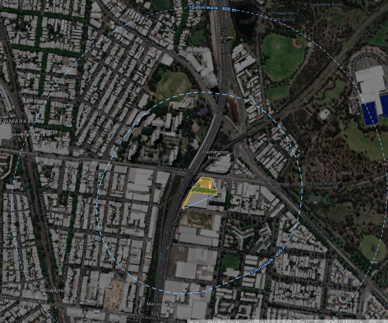
Search any address or suburb in Greater Melbourne and fly straight there.
Outline a site, choose a development type, and the buildings appear.
New homes, people and value update as you design, ready to test against 25 planning models.
Population
+0
Homes
+0
Value
$0.0M
UrbanMind’s North Melbourne example. Imagery © Esri, Maxar, Earthstar Geographics; © OpenMapTiles, © OpenStreetMap contributors.
Websites, 3D, AI, maps and launch media
Mazdak's portfolio (opens in a new tab)Complex software and systems (C++, .NET, Angular)
The people you meet are the people who build it. No hand-offs.
We take on a handful of projects a year so each one gets our full attention. No rush jobs.
We measure real enquiries and sales — not empty page views — and we'll tell you when ads aren't worth it yet.
A few lines is enough. No long brief needed.
We listen, ask the right questions and tell you honestly if we're a good fit.
What we'll build, when, and what it costs. No surprises later.
You see progress along the way, and we stay with you after launch.
Every project gets a clear, fixed quote after the call, before any work begins. No rush jobs. If we’re full, we’ll give you an honest start date.
Taking new projects
Tell us in a few lines. We’ll read it ourselves and tell you honestly how we can help.
Tell us what you need